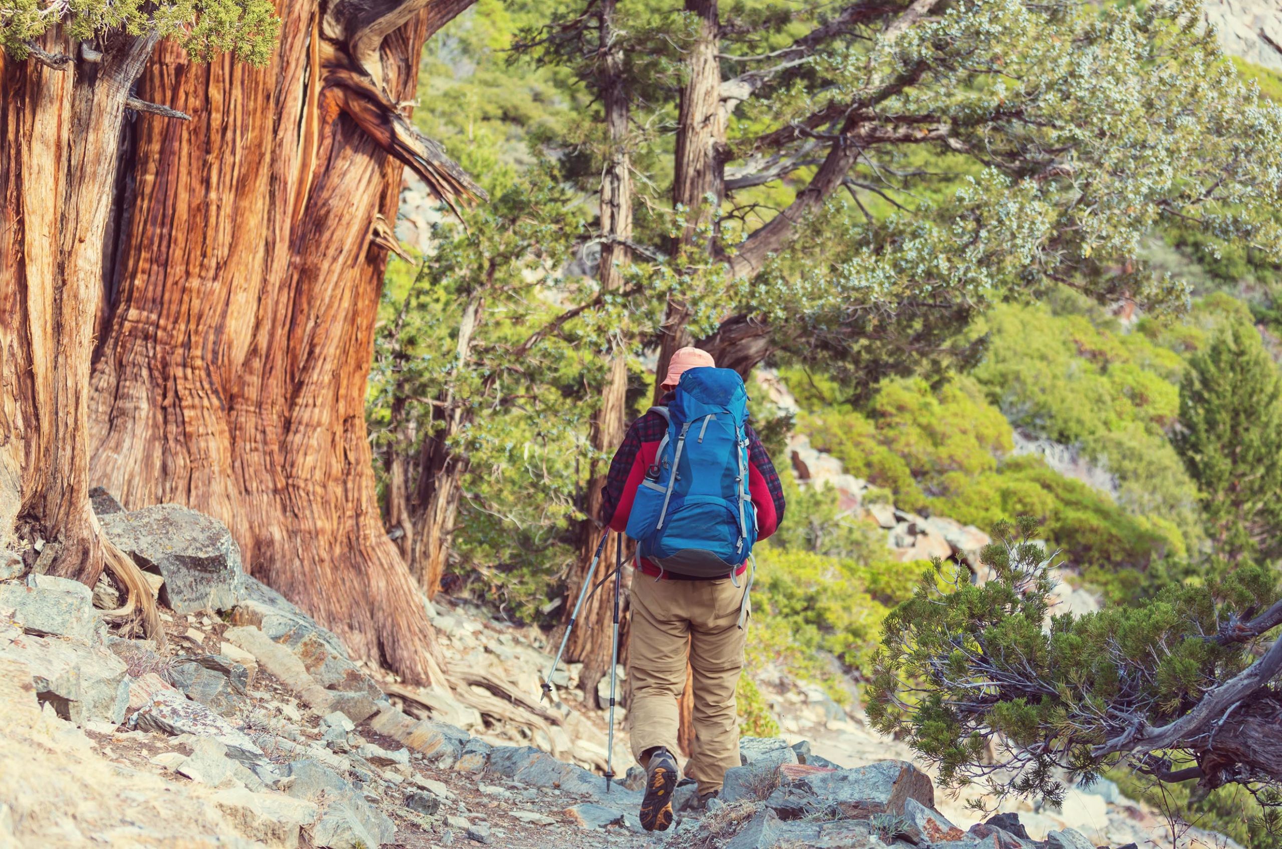
Hit the trails in California’s Tuolumne County

Hit the trails

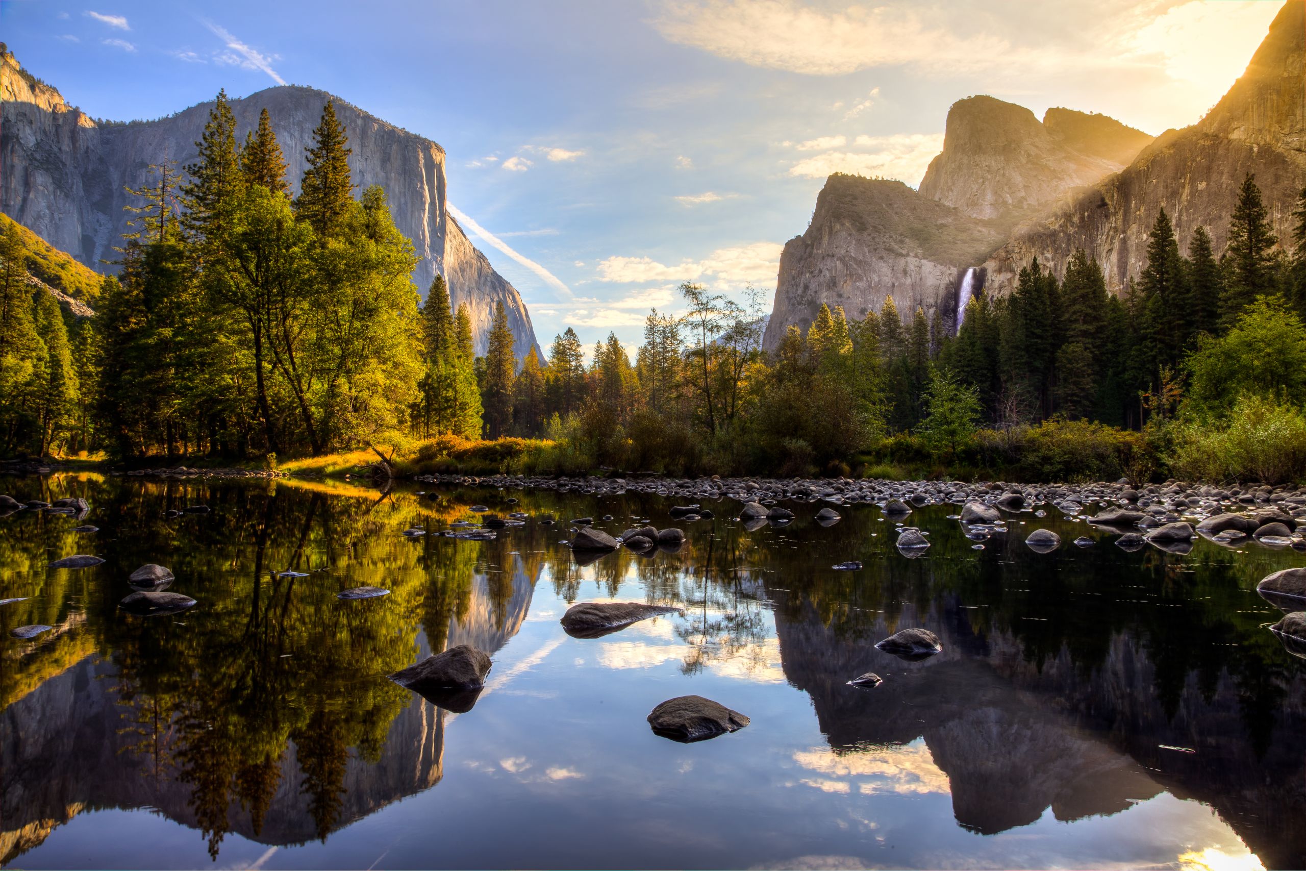
Ruled by the Sierra Nevada mountain range, Tuolumne County is an empire of quaint towns and old-growth forests – right in the crook of California’s elbow. Less than two-and-a-half hours from the San Francisco Bay Area, this is outdoorsy California as the locals experience it. To the county’s west is the erstwhile stomping ground of Gold Rush prospectors, where 19th-century boom towns are surrounded by pine forest. Northeast of here rise the High Sierra, where walking trails trace hair-raising valleys and jewel-like lakes. Best of all, there’s Yosemite National Park: more than half of this iconic preserve lies within Tuolumne County.
Scroll down to start exploring the trails, but before you do, be sure to hit play on our Tuolumne playlist...
Why walk in Tuolumne County?

Yosemite National Park’s granite peaks and shimmering waterfalls need little introduction – and they deservedly attract vast crowds. That’s why locals head to the less-visited northern half of the park in Tuolumne County: it’s perfect for quiet immersion in nature.
But even beyond Yosemite’s myriad trails, Tuolumne is a hiker’s Shangri-La. Gold Country frontier towns, such as Sonora and Jamestown, are springboards into surrounding wilderness (and you’ll be back in time for dinner and drinks). There’s also a plethora of easy and moderate walking paths in the High Sierra – ideal for families and beginners – plus plenty of more challenging trails.
Not sure where to start? Tuolumne’s Trail Heads programme equips visitors with a downloadable map of Top 12 rewarding hikes, along with trail information and interactive maps.
Here’s our pick of six of the most invigorating walks in California’s unsung fresh-air paradise…


Hiking in Gold Country

Dragoon Gulch Trail
Difficulty: Easy to moderate
Length: 5km
Looking for a blend of history and hiking? At Dragoon Gulch, you can blaze a trail through Gold Country, then return to town for sightseeing and merry-making.
The trail begins just west of Sonora town. Prosperous Sonora was founded by Mexican miners and became known as ‘Queen of the Southern Mines’; it’s one of numerous townships that bloomed after the discovery of precious metals in the Sierra foothills in the late 1840s.
Find Dragoon Gulch’s trailhead at Woods Creek Rotary Park (off Highway 49) or head to the ADA (accessible) trailhead at the end of Alpine Lane. The first section, North Forest Trail, winds through majestic black oaks, which cling to a steep-sided ravine. You’ll reach a creek crossing at the bottom of Dragoon Gulch – which is named after US cavalry soldiers who began mining the ravine in 1849. Continue up Creekside Trail, along a seasonal creek shaded by white alders, then follow ridge-side Vista Trail to a panoramic overlook across the valley.
This walk is enchanting during spring and summer, when wild roses bloom, but mellow autumn temperatures make this an enjoyable ramble well into October.
Don't miss...
Delving deeper into Gold Rush history at the trio of museums in quaint Sonora.
West Side Trail
Difficulty: Moderate
Length: 16km
Mining and logging transformed the Sierra foothills, but along the West Side Trail, you’ll witness nature reclaiming the land.
Beginning just northeast of downtown Tuolumne, the West Side Trail weaves along verdant cliffsides and through tunnels of oak. This thrilling hike traces a narrow-gauge rail route, along which the West Side Lumber Company once hauled goods through the Sierra. For parts of the trail, you’ll follow almost intact sections of the bygone railway line – the last of its kind in the American West. Elsewhere, erosion and storms have claimed the railway; watch out for lone ruts poking through the soil (look closely and you’ll see they’re inscribed with 1907, the date they were forged).
The West Side Trail reaches a few miles beyond the edge of Stanislaus National Forest, a dense wilderness of white fir trees, red-barked manzanita shrubs, and twisting rivers and streams. It’s prettiest in spring and summer, when purple lupines dapple the valley. You can tackle the trail by foot, horseback, with dog in tow, or even by bike, just watch your tyres on the rail ruts!
Don't miss...
Tucking into fruit-crammed pies at Cover’s Apple Ranch, 10 minutes’ drive west.
Hiking in the High Sierra

Pinecrest Lake Loop
Difficulty: Easy
Length: 6.3km
East of Tuolumne’s Gold Country, the landscape gets even wilder. Here in the High Sierra, rivers course through sheer valleys, and forests are home to mule deer, black bears and mountain lions.
When Gold Rush settlers ventured out this way, they built dams to secure water sources for their budding towns. Many of the resulting lakes are now beauty spots beloved by hikers – particularly Pinecrest. This 1.2 sq km lake sparkles 48km east of Sonora (less than a mile off Highway 108), and a walking trail wraps all the way around.
Start at the lake marina and walk clockwise: silver pines shade the gently undulating trail from the bright California sunshine, and you'll see bold chipmunks and striped ground squirrels scampering between the trees (please do not feed them). Pinecrest Lake’s glassy waters are deservedly popular with families, and they're teeming with rainbow trout. Stick around to dip a fishing rod (permit required), take a dip (Beach 1 is reserved exclusively for swimmers), or camp right by the water's edge.
Want a wintry experience instead? Clad in snowshoes, you can walk a circuit of Pinecrest Lake even when frost dusts the trees and pillowy snowbanks line the shore.
Don't miss...
Trekking among granite peaks and glacier-scoured plains in the Emigrant Wilderness.
Relief Reservoir Trail
Difficulty: Moderate to difficult
Length: 9.8km
Following the Middle Fork of the thrashing Stanislaus River, the Relief Reservoir Trail rewards hikers with views of monumental rock formations and an inky-blue lake. It’s a tiring there-and-back hike for a single day, or you can camp overnight before returning from trail’s end.
After tramping south through Kennedy Meadows, you’ll survey towering stands of Jeffrey pine trees, admire natural pools, pass hulking granite rock formations, and cross a wooden bridge over the foaming Stanislaus River. At the final, calf-stiffening 400m ascent, you’ll be rewarded by glimpses of the High Sierra, which remain streaked with snow into early summer. At the highest point (2,316m), you’ll gaze across the Relief Reservoir, before the trail points downhill toward Grouse Creek. Just across the creek you’ll reach a lakeshore campsite, where you can pitch a tent and watch the sunset paint the mountains gold.
Hiking in Yosemite National Park

Pacific Crest Trail segment
Difficulty: Moderate to difficult
Length: 19.5km
Extending 4270 mighty kilometres from Campo in southern California right to the Canadian border, the Pacific Crest Trail (PCT) is a true hiking odyssey.
Made famous by Cheryl Strayed's solo hiking memoir Wild, many trekkers have been inspired to unlock their inner strength on this long-distance route, which spans an eye-poppingly diverse range of forests, deserts and snow-kissed mountains. But if you don't have months to spare, you can experience a moderately tough day-long section of the PCT in Tuolumne County.
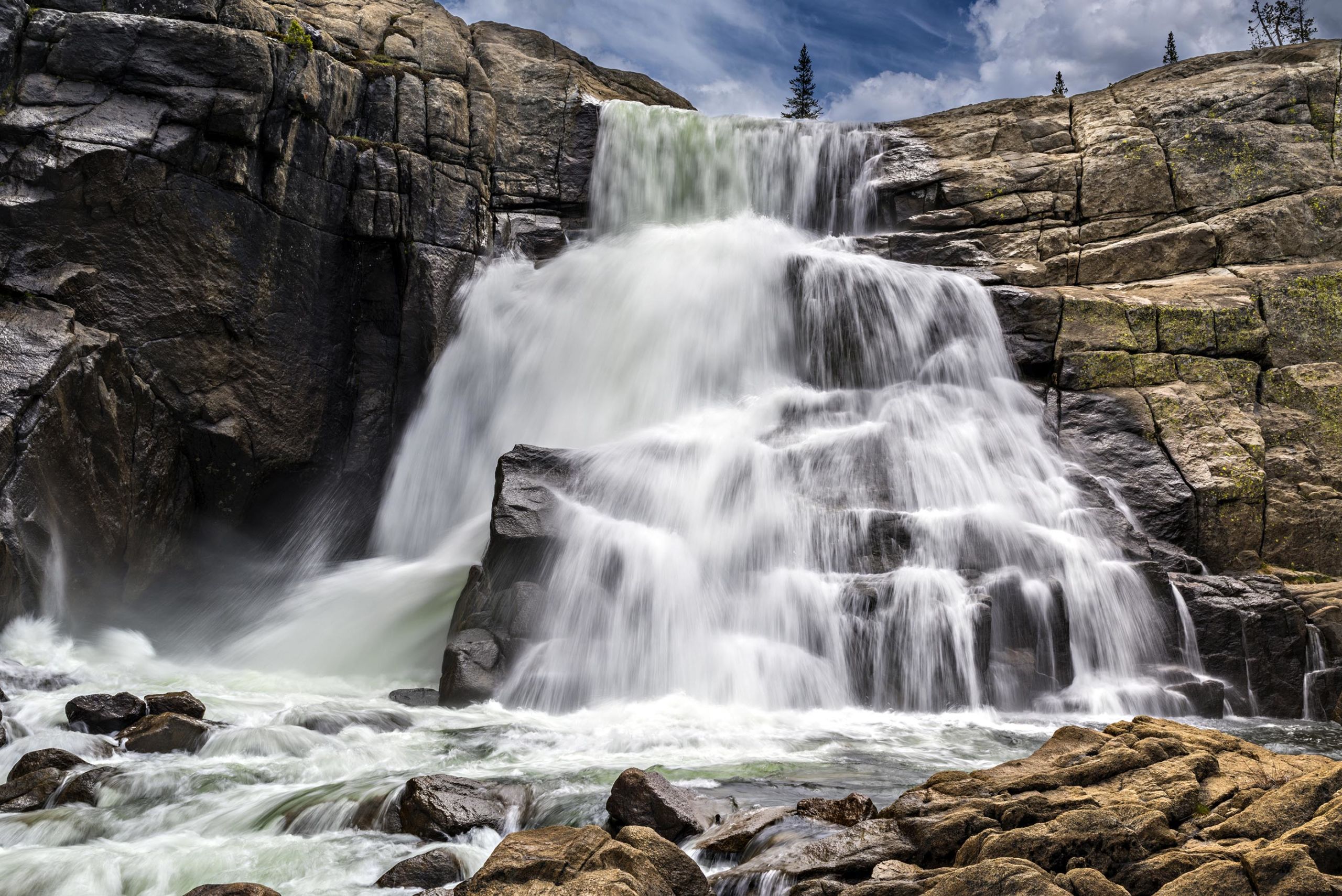
The trail segment begins in Yosemite National Park's Tuolumne Meadows – the Sierra Nevada's largest subalpine meadow. This high-elevation pastureland (2,620m) is dazzlingly verdant in springtime, thanks to groundwater that feeds hyacinths, buttercups and voluminous reed grass. Waterfalls and tranquil woodlands fringe the trail, which follows the Tuolumne River for miles. When you reach Glen Aulin High Sierra Camp, you'll find yourself at the heart of granite country, where Tuolumne Falls tumbles down a sheer rock face. Cool off with a dip near the cascade, or set up camp if you want to delay the 305m ascent on the return journey back to Tuolumne.
Don't miss...
Contemplating old-growth sequoias in Tuolumne Grove, 50 minutes’ drive west.
Wapama and Rancheria Falls Trail
Difficulty: Moderate to tough
Length: 21.6km
Want to gaze across Yosemite’s yawning valleys and feel the mist of colossal cascades? This there-and-back trail twists through Hetch Hetchy, the least-visited section of Yosemite National Park, and you'll enjoy water-splashed views the whole way – particularly if you hike during springtime.
The naturalist John Muir described this valley as “one of nature's rarest and most precious mountain temples”. The valley has since been flooded by the O’Shaughnessy Dam; monoliths Kolana Rock (610m) and Hetch Hetchy Dome (1,889m) now rise from the waters of Hetch Hetchy Reservoir.
Begin your hike at the dam, 10km northeast of Mather, and follow the shoreline to Wapama Falls, the larger of northern Hetch Hetchy Valley’s year-round cascades. Most hikers finish here, but press onwards to Rancheria Falls, a pleasing cascade that bounces for 300m along a rocky canyon.
Though the route's elevation gain is only 240m overall, it’s a deceptively tiring trail; depending on your fitness and energy levels, you might take eight hours to Rancheria Falls and back. Alternatively, bring your tent, sleep in Yosemite’s sweet silence, then start fresh in the morning. Surrounded by such natural splendour, there’s no need to rush…


