Trace the Alpe-Adria-Trail

Slovenia’s greatest walk
Trace the Alpe-Adria-Trail
By Rudolf Abraham


The Alpe-Adria-Trail is a superb 750km hiking route, stretching from the peaks of the Alps to the shore of the Adriatic. Starting from the foot of Austria’s highest mountain, the Grossglockner, it winds through Carinthia, before crossing the Karavanke into Slovenia – where it takes in a great, sweeping section of the Julian Alps, Triglav National Park and the Soča Valley. It spends several days jumping back and forth between Slovenia and Italy, exploring the Karst region and the Goriška Brda wine region, to end in Muggia on the Adriatic coast. The Alpe-Adria is the perfect way to experience the breathtaking scenery, rich culture and delicious food and wine Slovenia has to offer at a slow pace.


Explore the Alpe-Adria-Trail for yourself with this interactive map as it winds its way through Slovenia. Let’s take a walk…
E22: Baumgartnerhöhe – Kranjska Gora
Distance: 21.6km
Time to walk: 8 hours
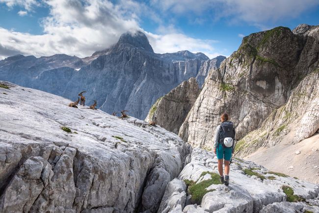
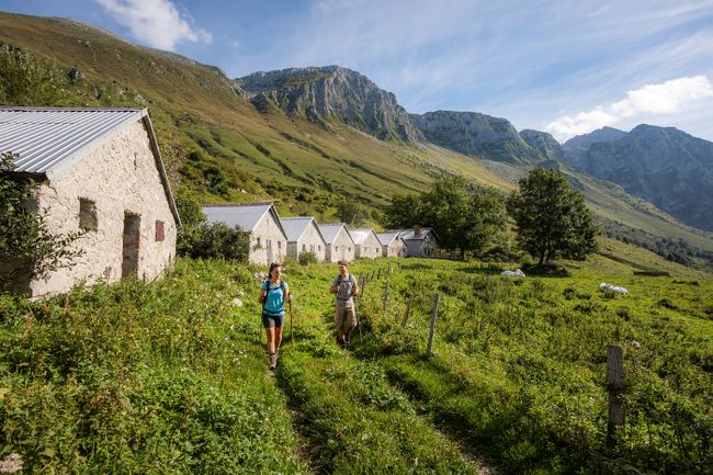
You can see the Karavanke mountains, which run along the border between Austria and Slovenia, for several days before you reach them. The Alpe Adria Trail enters Slovenia by way of a spectacular ridge walk, following a trail along the crest of the Karavanke with jaw-dropping views on either side, before descending to the small town of Kranjska Gora, one of the main gateways to Triglav National Park.
Cultural highlight: Zelenci Nature Reserve
Set among reed beds and meandering streams, the small lake at the heart of this wetland area is the most incredibly vivid blue-green colour. The source of the Sava Dolinka river, the lake can be reached by wooden boardwalks, and is fed by underground channels which you can see bubbling up from the lakebed.


Epic view: Srednji vrh
As in introduction to the Julian Alps, the view from Srednji vrh is as good as any you could hope for. Standing here among open pastures beside an idyllic cottage, the Martuljek Group faces you across the Sava Valley, rising in a great amphitheatre of pyramid-shaped peaks, above a sprawl of rock and forest.
Must-try refuel food: Krapi
These delicious traditional dumplings are a specialty of Rateče, a small village near Kranjska Gora, and have a filling of curd cheese, polenta and a hint of fresh tarragon.


E23: Kranjska Gora – Trenta
Distance: 22.6km
Time to walk: 8 hours
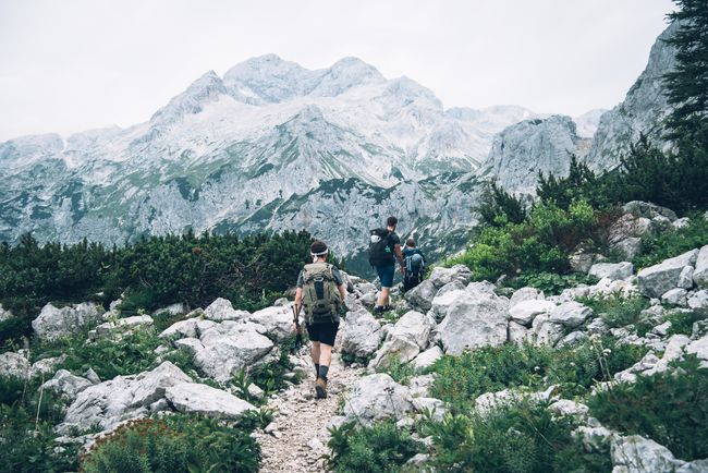
This superb hike takes you over the 1,611m Vršič Pass, and comes with fabulous views of Prisojnik, with its rock window and distinctive cliff which looks strangely like a human face. From the cluster of mountain huts at the pass, the trail leads down into the upper reaches of the Trenta Valley, passing the source of the emerald green River Soča, and into the heart of Triglav National Park.


Cultural highlight: Russian Chapel
This small wooden chapel beside the road leading up to the Vršič Pass was built during WW1, in memory of Russian prisoners of war who were killed during an avalanche, while working to build a military road over the pass, intended as a supply route to the Isonzo Front.
Epic view: Lake Jasna
Viewed on the map, this small manmade lake just an hour’s walk out from Kranjska Gora seems an unassuming little place. But the view across the lake towards the majestic peaks of Razor and Prisojnik, which you’ll find reflected in its surface, is absolutely sublime. While you’re here, bear in mind there’s a fantastic, two-Michelin-starred restaurant beside the lake, Milka.


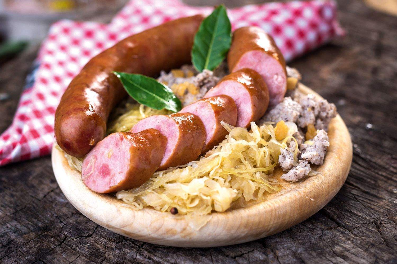
Must-try refuel food: Gorenjski želodec
This traditional cured sausage made with ground pork and millet, is a speciality of the Upper Savinja Valley in northern Slovenia.
E24: Trenta – Bovec
Distance: 21.3km
Time to walk: 6 hours 30 minutes
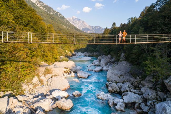
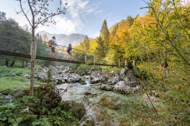
One of the finest sections on the entire Alpe Adria Trail, this stage follows the exquisitely beautiful River Soča – along riverside paths, across open pastures, through patches of forest, and taking in the unforgettable Soča Gorge. The Soča is deservedly popular for kayaking, and also has some good spots for swimming.
Cultural highlight: Explore Bovec town
The pretty little mountain town of Bovec makes for a wonderful spot to linger for a rest day, surrounded by dramatic mountain peaks including Mt Rombon and the sinuous, fin-shaped Svinjak. Visit the restored WW1 bunkers and trenches at Rabelnik, take the cable car up Mt Kanin, and make a detour up the Koritnica Valley to Fort Kluž, which stands above a narrow, sheer-sided gorge.


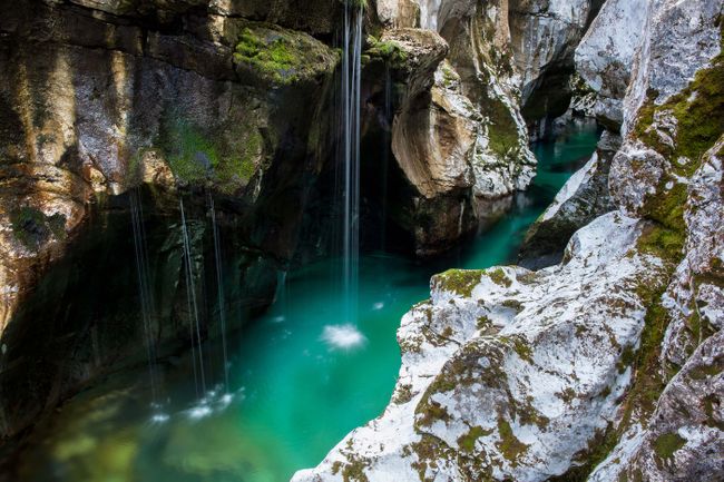
Epic view: Soča Gorge
Between Trenta and Bovec, the Soča passes through a spectacular gorge – some 15m deep and less than 2m wide at the top, the river twisting through its depths between sculpted cliffs, pierced by shafts of sunlight. As well as seeing the gorge itself, make sure you stop where the river widens out below the lower end of the gorge, which is a popular place for swimming.

Must-try refuel food: Bovec cheese
Bovški sir is a delicious cheese from the area around Bovec, made with milk from the local breed of sheep, with PDO status.


E25: Bovec – Drežnica
Distance: 25.1km
Time to walk: 7 hours 15 minutes
This stage continues following the river Soča, before climbing to the village of Drežnica. Not far away, the small town of Kobarid is home to an excellent museum covering local WW1 history – and also to one of the best restaurants in Slovenia. This is the three-Michelin-starred Hiša Franko, where legendary chef Ana Roš (voted third best chef in the world) creates an unforgettable fine dining experience, with an emphasis on local seasonal ingredients.

Cultural highlight: Visit the village of Drežnica
The small mountain village of Drežnica sits on an open hillside below a soaring wall of mountains, culminating in 2,244m Mt Krn. Drežnica is known for its vivid Shrovetide carnival traditions, where local unmarried men cavort about the village dressed in sheepskins and elaborate wooden masks, which they carve themselves.
Epic view: Boka waterfall and Bovec panorama
The Boka waterfall comes spurting out of a cliff before free-falling 106m into the rocky valley below, followed by a drop of another 30m. The highest waterfall in Slovenia, it can be seen from the trail itself – or for enhanced views, make a short and worthwhile detour up to a viewpoint closer to the falls.


Must-try refuel food: Frika
Don’t leave the Soča valley without trying frika – a great mouthwatering wedge of sliced potatoes fried with local Tolminc cheese (something like a tortilla with no eggs).
E26: Drežnica – Tolmin
Distance: 23.2km
Time to walk: 9 hours
From Drežnica the trail climbs to the small chapel on Mt Planica, built by Italian troops during WW1, then descends past the Kuhinja mountain hut to rejoin the river Soča, finishing in the town of Tolmin.
Cultural highlight: The Javorca monument
During the First World War the front line between Italy and Austria, the Isonzo Front, lay along the Soča Valley – and remains of this conflict still lie scattered along the valley floor as well as on the slopes and mountains above. One of the most beautiful is the Memorial Church of the Holy Spirit at Javorca, in the hills above Tolmin. This wooden church is reached by a long flight of stone steps, and has slender, painted columns inside, along with foldout wooden panels inscribed with the names of the fallen.
Epic view: Triglav National Park and Soča valley

Here on the edge of Triglav National Park, at its lowest elevation, you’ll find the beautiful Tolmin Gorges, at the confluence of the Tolminka and Zadlaščica streams. Along with all the rushing water, you’ll find narrow cliffs pierced by galleries, and the so-called ‘bear’s head’ – a gigantic triangle of rock wedged between two cliffs and suspended above the stream.
Must-try refuel food: Tolminc cheese
Tolminc is a full-fat hard cheese from the high pastures above Tolmin – delicious on its own, and an essential ingredient in frika.

E27: Tolmin – Tribil Superiore
Distance: 19.3km
Time to walk: 7 hours 30 minutes
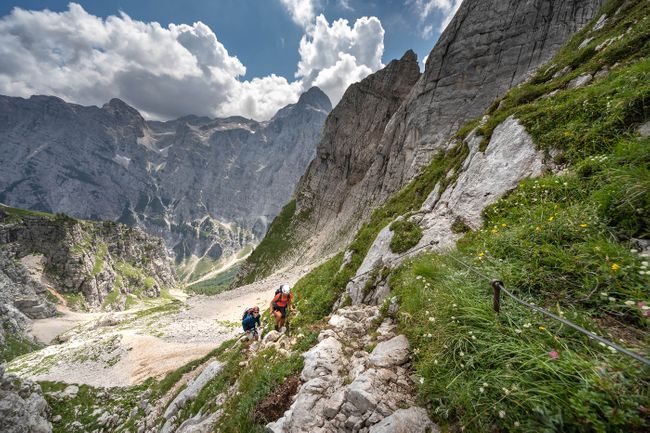
From Tolmin, the Alpe Adria crosses the Soča then climbs gradually through forest to the Kolovrat ridge, with its spectacularly restored series of First World War trenches, before descending into the upper reaches of the Val di Natisone in Italy. Rifugio Solarie, just below Kolovrat, is a popular mountain hut which makes a perfect place to stop for lunch.

Cultural highlight: Tolmin Museum
Housed in a former mansion, the Tolmin Museum is the best place to go to learn more about the history and archaeology of this part of the Soča valley, from the Stone Age to the 20th century. The museum also overseas the exceptional finds from the Bronze Age archaeological site at nearby Most na Soči, which are exhibited there.
Epic view: Kolovrat Mountain
The Kolovrat ridge forms the border between Slovenia and Italy, and was heavily fortified during WW1. At the Kolovrat Open Air Museum, you’ll find an extensive and hugely impressive system of well-restored trenches, bunkers, and gun emplacements, which snake their way across the hillside and which you can walk through on your way up to the peak of Na Gradu.

Must-try refuel food: Soča trout
The river Soča is famous for its trout – and you’ll find grilled trout gracing the menus of many restaurants in the area.
E29: Cividale – Breg Pri Golem Brdu
Distance: 13.2km
Time to walk: 4 hours 15 minutes
From UNESCO-listed Cividale dei Friuli, the former Lombard capital, this section of the Alpe-Adria passes through wine country (Colli Orientali del Friuli DOC), before crossing back into Slovenia at the River Idrija. From here it ascends to the tiny settlement of Breg Pri Golem Brdu, which stands on a low, wooded hill above the river, overlooking the surrounding countryside.
Cultural highlight: Breg village
Breg, as it’s known among friends, is a quiet little place, where you can enjoy a lazy afternoon following this short stage admiring the view, soaking up some of the excellent local wine, and visiting a couple of churches. The Church of St Helen is typical of this region, with a simple portico, and a prominent campanile, while the nearby church of St Andrew has the earliest frescoes in the Brda region, depicting scenes from the Life of Christ.

Epic view: Viewpoint outside Breg
Along with all the vineyards, and of course the so-called Devil’s Bridge by which you leave Cividale, the best viewpoint on this section of the trail is the info point just outside Breg, which overlooks the vineyards on the Italian side of the river Idrija.

Must-try refuel food: Dried salami, homemade bread and olive oil
Enjoy local salami and other cured meats along with crusty home made bread and deeply flavoured olive oil.


E30: Breg Pri Golem Brdu – Šmartno
Distance: 26km
Time to walk: 7 hours 45 minutes
Hike through villages, vineyards and rolling hills of one of Slovenia’s best wine regions, Goriška Brda. Pass the Renaissance castle at Dobrovo – also home to a massive wine cellar – and climb the Gonjače observation tower for fantastic views.
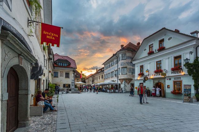
Cultural highlight: Šmartno village
The beautifully preserved walled village of Šmartno stands on a strategic hill at the heart of the Brda wine region. The historic core with its twisting, cobbled streets and St Martin’s Church with its crenellated spire, are all surrounded by stout medieval walls and towers, and there are some cosy little places to enjoy a well-earned dinner at the end of another day on the trail.

Epic view: Gonjače observation tower
A little way outside Šmartno, the Gonjače observation tower offers a staggering 360 degree panorama of the surrounding countryside. Standing on a low hill, the 23m high metal tower has 144 steps and three storeys, and the views are phenomenal – taking in the Brda wine country, the plains of Friuli and the Julian Alps, and on a clear day you can clearly see the Dolomites.

Must-try refuel food: Traditional Slovenian wine
Šmartno lies at the heart of Goriška Brda – one of Slovenia’s top wine regions, sandwiched between the Adriatic and the foothills of the Julian Alps. You’ll find plenty of vineyards open for tastings. The area is particularly well known for its Rebula.
E31: Šmartno – Cormons
Distance: 14.9km
Time to walk: 5 hours
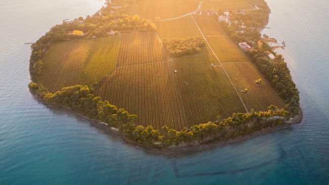
Hemmed in between the Alps and the Adriatic Sea, the leafy rolling hills that make up the Brda region are packed with nutrient-rich soil. This has led to Brda garnering fame for its wine-growing prowess, with vineyards and orchards patchworking the landscape you’ll weave through as you cross back into Italy.
Cultural highlight: Dobrovo Castle
Lording over hill-topped Brda, the 17th-century Renaissance-style Dobrovo Castle is both a living museum, home to many period furnishings dating back to its construction in 1606, as well as a fine art gallery that exhibits work by world-renowned artists, including Slovene painter Zoran Mušič. Make sure you allow time to visit the wine shop tucked away in the castle’s cellar, where you can try vintages from all across the Brda region.

Epic view: The vineyards of Brda
Striping the bubblewrap-like vistas of Brda, the region’s rolling vineyards make for handsome bucolic panoramas. But it’s not only about the landscapes primed for grape-growing; the contrast with the pockets of oak forest that once dominated this land and sprinklings of cherry trees combine for one of Slovenia’s most sumptuous views.


Must-try refuel food: Krodegini and markandele (sausages)
Pig farming has a rich heritage across Slovenia and this is also the case across the Brda region, which specialises in two varieties well worth trying: krodegini (pork skins sausages) and markandele (pig offal sausages).
E35: Prosecco – Lipica
Distance: 20.6km
Time to walk: 6 hours
After following the historic Strada Vicentino along the edge of the Karst plateau, with its breathtaking views out over the Adriatic, this stage returns to Slovenia and finishes at the historic Lipica Stud Farm.
Cultural highlight: Lipica Stud Farm
Lipica is the original stud farm for the Lipizzaner breed, founded in the 16th century by the Habsburg Archduke Charles II. As well seeing the horses – there are over 300 at the farm – there are guided tours of the stud farm including the historic stables, and there’s a museum where you can learn more about the history of the breed and the stud farm itself. You can also watch a show by the Lipizzaner Riding School.
Epic view: Lipizzaner horses in nature

The real highlight of Lipica is the horses themselves, roaming and grazing the extensive paddocks of the farm’s 300 hectares. For a truly memorable sight, try to catch the moment when the horses are let out into the paddocks in the morning, as they go charging out along a fenced enclosure.
Must-try refuel food: Kraški pršut (Karst prosciutto)
Slovenia’s finest pršut (prosciutto) comes from the Kras region, where the harsh, dry climate and strong winds are particularly well suited to producing dry-cured ham. After salting, the process of ageing and drying takes at least 12 months.

E36: Lipica – Bagnoli Della Rosandra
Distance: 17.3km
Time to walk: 6 hours
From Lipica, the trail goes over Kokoš (Chicken) Hill and across one side of Veliko Gradišče, at 742m the highest peak on this part of the Karst plateau. It then follows the course of the former Trieste-Hrpelje railway, now transformed into an excellent cycling and hiking route, before passing through the amazing karst landscape and nature reserve of Val Rosandra.
Cultural highlight: Vilenica Cave
Only a short detour from the Alpe Adria, the Vilenica Cave is possibly the earliest show-cave in Europe, with the first recorded visits dating back to 1633, when an admission fee was already being charged by the local Count and the parish. Formed by an underground river, this limestone cave is over 1km long and has plenty of impressive stalactites and stalagmites, with the first 450m being accessible to the public.


Epic view: Kokoš (Chicken) Hill
Mt Kokoš is a forested hill on the Slovenian-Italian border, just a smidgin over 670m high, with a clearing at the top which offers some of the best views anywhere on the Karst plateau. You can see the remains of a Bronze Age burial mound up here, and there’s a well-placed mountain hut nearby.

Must-try refuel food: Teran wine
The definitive wine of Slovenia’s Kras region is Teran, a robust red which matches perfectly with a platter of local pršut and cheeses.
E37: Bagnoli Della Rosanda – Muggia
Distance: 23.7km
Time to walk: 7 hours

On its final stage, the Alpe-Adria originally ran through Italy – making for a rather underwhelming grand finale, since it passed through several industrial areas. This section has now been rerouted to stay mostly in Slovenia – a much more scenic choice, which takes you up across the jagged karst landscape of Mali Kras (Monte Carso). The last proper hill on the Alpe Adria, this offers superb views out across the Gulf of Trieste, as well as back across the beautiful Val Rosandra. The trail then leads past Socerb castle and through the village of Tinjan, before crossing into Italy and descending to Muggia, making for a suitably rewarding end to a 750km trek from the Alps to the Adriatic.
Feeling inspired?
For more information and to start planning your own epic walk along the Alpe-Adria-Trail, head to the official trail website.

Image captions